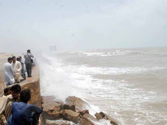
Photo: PPI
Karachi: The distance of the cyclone “Bepar Joy” formed in the Arabian Sea has further decreased from Karachi, while the Meteorological Department has indicated the possibility of strong winds, wind and thundershowers in the city due to the storm.
The Meteorological Department has issued the 11th alert regarding Cyclone Bepar Joy, according to which the extremely severe cyclone has intensified in the East-Central Arabian Sea. The storm, which turned into a very severe one, continued to move towards the north during the last 12 hours.
According to the ongoing alert, the storm is currently 760 km south of Karachi, 740 km from Thatt and 840 km from Ormara. Winds are blowing at a speed of 150 to 160 km per hour in and around the center of the storm, while the speed of the accompanying winds is exceeding 180 km per hour.
Wave heights have been unusually high up to 40 feet. Favorable atmospheric conditions and temperatures of 30 to 32 degrees Celsius and vertical upper-level winds can sustain the storm’s intensity.
Amidst these factors, the cyclone may track further northward by the morning of June 14. Later, the cyclone may turn north-east and cross the region between Kati Bandar (southeast Sindh) and India.
According to the Department of Meteorology, on the afternoon of June 15, the cyclone will be present on the coast of the Indian state of Gujarat in a very severe form. Possible impacts include widespread winds, dust/thundershowers along the coast of Southeast Sindh while gusty winds of 80 to 100 kmph may cause damage to vulnerable properties.
Due to the cyclone, there is a possibility of rain with thunder in the districts of Thatta, Sajawal, Badin, Tharparkar and Umarkot between June 13 and 17, while there is a possibility of rain in Karachi, Hyderabad, Tando Muhammad Khan, Tandwalhiar and Mirpurkhas districts on June 13 and 16. Is.
Winds of 60 to 80 km/h may also blow during this time, strong winds may damage weak structures (some houses).
Anomalous conditions are expected in and around Katy Bunder near the potential landfall point of the cyclone (India). Fishermen have been advised not to venture into the open sea till June 17.
(function(d, s, id){
var js, fjs = d.getElementsByTagName(s)[0];
if (d.getElementById(id)) {return;}
js = d.createElement(s); js.id = id;
js.src = “//connect.facebook.net/en_US/sdk.js#xfbml=1&version=v2.3&appId=770767426360150”;
fjs.parentNode.insertBefore(js, fjs);
}(document, ‘script’, ‘facebook-jssdk’));
(function(d, s, id) {
var js, fjs = d.getElementsByTagName(s)[0];
if (d.getElementById(id)) return;
js = d.createElement(s); js.id = id;
js.src = “//connect.facebook.net/en_GB/sdk.js#xfbml=1&version=v2.7”;
fjs.parentNode.insertBefore(js, fjs);
}(document, ‘script’, ‘facebook-jssdk’));


