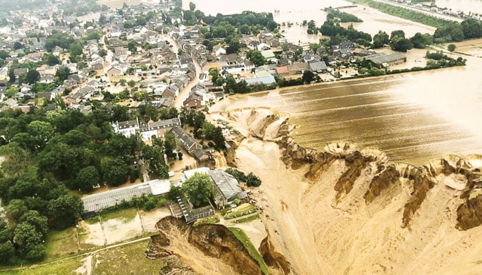
Just as climate change is accompanied by cloud cover and melting of snow, it is a natural process. In this way, the waves of the flowing springs and then the rivers created by it are converted into tidal waves, i.e., due to the huge increase in mass and velocity of the water, the water exits its intended channel and enters its path. Flooding is also a natural process called ‘flooding’, which is caused by heavy rains, melting of glaciers from high mountains, sudden bursts of water-bearing clouds and lightning storms. .
In normal condition, water from springs and rivers meanders like a snake and flows very calmly towards its destination i.e. the sea. These are all passages of river travel called “meanders”, the discharge of which is accompanied by bascflow, the vertical height of which is limited to the inside of the channel. and this passage of water is only charged with ground water.
Because of this, there are low tides on it and no tides. But when, under the influence of the above mentioned factors, large relays of water enter the creative channel of the rivers with high speed, then the condition of “flood” is created in the flood, because in this situation, the water flows from the rivers’ own channels. Coming up, it starts flowing with great speed and soon covers vast areas horizontally on both sides of the channel.
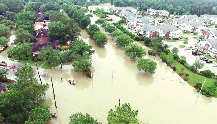
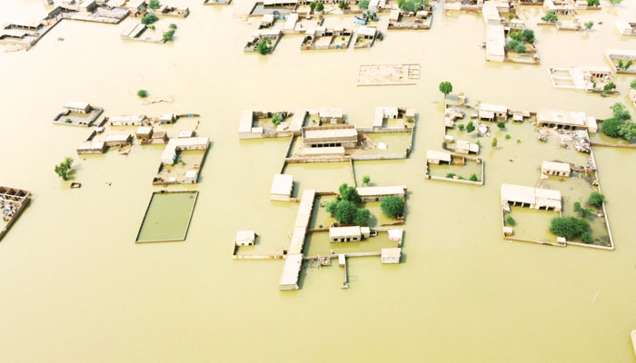
It is not just water but consists of mud, silt and large and small rock fragments. For this reason, it is sometimes called a “rock flood”, because there is more rock than water. For example, the recent flood in Pakistan in 2022. The areas containing all these floodplains dry out over time after the floodplain has passed and are always present as a flood channel, forming a very desert plain known as “ “Flood Plain” is called. As the height of springs and rivers varies in different regions.
For this reason, the spread of the “flood plain” depends on the extent, height and intensity of the flood. While traversing the floodplain during the geological survey, it has been observed that vast “floodplains” are gradually drained away into flat plains attracted by fertile soil. are For example, Florence, Italy is built on riverbanks and floodplains, which is because the river is an important means of transportation or travel for ships, but it is in no way suitable for a natural disaster.
This is because not every river floods every year but it is a natural process of all rivers where low and high level floods occur. “Flood plains” created by low-level floods are used for agriculture, for example, the annual low-level floods of the Nile River in Egypt transform the surrounding land into a floodplain, with a layer of clay. It freezes, in which many crops are grown.
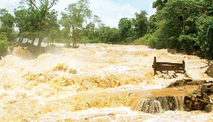
As large and destructive floods are less frequent. Due to this, the natural reality of the flood plain has been put aside and used for various purposes all over the world. However, it was necessary that prior to this, records regarding natural calamities such as floods should have been thoroughly analyzed in the geological history of these areas. To achieve this goal in the world, numbers are guided by wave graphs, because human consciousness has learned the fact that just as “volcanoes” are never dead, it is 100 years, 200 years or 400 years. Even after that, fires start to erupt due to which the surrounding population is buried under the debris and lost forever.
For example, the volcano of Begota, similarly, the flood plain should not be converted into a residence or a restaurant, knowing that it is dry and barren, because at any time when the floodplain is born, the floodwaters in every solution. The ancient flood will sweep through the plain and overturn everything. For example, the 1993 flood, which is considered one of the world’s largest and most destructive floods, destroyed 6.6 million acres of the American city of Bismarck, North Dakota and other flood plains, in which 38 people lost their lives. And $12 billion in irreparable damage to housing and crops. This was a response to the damming of the floodplain.
The recent floods in Pakistan are a testament to a similar response, resulting in huge volumes of floodwaters, rapidity and massive boulders reaching the flood plains, destroying hotels, residential houses, power lines, etc. Poles, restaurants and underground mines were also defaced. On the other hand, driving in or entering flood water is also very dangerous and life-threatening.
According to a global analysis, a lateral pressure of 500 pounds affects an 800cc vehicle in one foot of flood water, causing the vehicle to sway, which is a very dangerous sign. A lateral force of 1000 and an upward force of 1500 pounds continue to act in 2 feet of water, and the vehicle comes to rest on two wheels. This is a very scary moment. If the water reaches a shallow depth, a part of the road collapses and the vehicles get submerged in the water. It has become the need of the hour to extend the scope of preventive measures to the empowered institutions to minimize the losses of these natural calamities.
By constructing flood control structures, the severity of the dangerous effects of flood water and sedimentation of riverine areas can be reduced. For example, the construction of Chcek Dam is very beneficial in controlling flood water. The dams of this distribution are all constructed on the small tribukay of the river, to capture the flood water from the springs and then use it as needed after the flood has passed. But it also requires a lot of attention, because silt and other suspended components keep accumulating in the reservoir at this time.
Therefore, regular attention should also be paid to its cleaning, which is cleaned by the method of “dredging”, in which a machine is installed to clean the silt in the genital channel. is, so that the depth of the dam does not decrease. At the same time, various countries are paying special attention to the construction of longitudinal embankment made of reinforced concrete, especially those countries whose cities, villages and recreational areas are located on the extreme banks of the river. have been done, so that the abundance of water in the channel can be limited to a considerable extent during the flood season. New river channels should be formed at different places even before the flood season. These are the measures, which allow for a timely response to the floodplain.
setTimeout(function(){
!function(f,b,e,v,n,t,s)
{if(f.fbq)return;n=f.fbq=function(){n.callMethod?
n.callMethod.apply(n,arguments):n.queue.push(arguments)};
if(!f._fbq)f._fbq=n;n.push=n;n.loaded=!0;n.version=’2.0′;
n.queue=[];t=b.createElement(e);t.async=!0;
t.src=v;s=b.getElementsByTagName(e)[0];
s.parentNode.insertBefore(t,s)}(window,document,’script’,
‘https://connect.facebook.net/en_US/fbevents.js’);
fbq(‘init’, ‘836181349842357’);
fbq(‘track’, ‘PageView’);
}, 6000);
/*setTimeout(function(){
(function (d, s, id) {
var js, fjs = d.getElementsByTagName(s)[0];
if (d.getElementById(id)) return;
js = d.createElement(s);
js.id = id;
js.src = “//connect.facebook.net/en_US/sdk.js#xfbml=1&version=v2.11&appId=580305968816694”;
fjs.parentNode.insertBefore(js, fjs);
}(document, ‘script’, ‘facebook-jssdk’));
}, 4000);*/

